Spring storms transform Northeastern Oregon snowpack
Published 2:00 pm Thursday, May 12, 2022
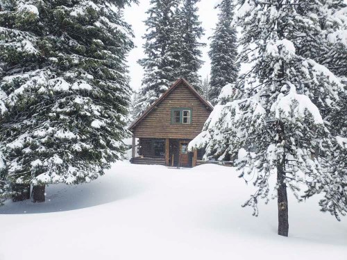
- Fresh snow mantled the trees around the Anthony Lake Guard Station, on the north shore of Anthony Lake, on Sunday, May 8, 2022.
BAKER CITY — April showers couldn’t completely make up for a meager winter snowpack in the mountains of Northeastern Oregon.
But the month put on a pretty fair rally.
Trending
And so far May has maintained the momentum, with snow falling not only in the mountains but also, most recently on Sunday, May 8, and Monday, May 9, in the valleys.
A persistent weather pattern over the past month that has pushed cool storms through the region regularly, laden with Pacific moisture, has transformed a paltry snowpack into one that, in some places, has soared well above average.
Statistics illustrate how stark the reversal has been.
During March, which in many years is the snowiest month at higher elevations, the water content in the snow — the statistic that best predicts summer water supplies — dropped at 13 of 17 measuring sites around the region. The water content was below average at all of those places by the end of March.
But the storms of April had a profound effect.
At High Ridge, for instance, in the northern Blue Mountains near Tollgate, the water content at the start of April was 17.8 inches — 74% of average.
Trending
By month’s end the water content had risen to 21.6 inches. More notably, that figure was 177% of average.
A similar trend prevailed at some other sites:
• Moss Springs above Cove — 76% of average at the start of April, 117% at the end.
• Bald Mountain, near Moss Springs — 59% to 109%.
• Mount Howard, near Wallowa Lake — 84% to 106%.
• Aneroid Lake, Eagle Cap Wilderness south of Wallowa Lake — 61% to 74%.
Jason Yencopal, Baker County emergency management director who also does snow surveys, plodded through the drifts to a meadow just east of Anthony Lake on the first day of May.
He measured 64 inches of snow — up from 49 inches at the end of March.
The water content rose during April from 19.5 inches — 61% of average — to 25.5 inches, 91% of average.
One damp month can’t end the region’s drought, to be sure.
As of May 3, all of Northeastern Oregon was in either moderate, severe or extreme drought, according to the U.S. Drought Monitor.
(The monitor uses a five-level rating system — abnormally dry, and four categories of drought, moderate, severe, extreme and exceptional.)
Most of Baker County remains in extreme drought, with a small part on the western side, and much of the Panhandle, in severe drought.
Phillips Reservoir in Sumpter Valley, which supplies irrigation water for more than 30,000 acres in Baker Valley, is holding just 12% of its capacity.
Thief Valley Reservoir, near North Powder, is full, and Unity Reservoir in southern Baker County is 92% full.
Marketplace

-
eEdition

-

-
