Mapping, counting, collecting and more
Published 9:05 pm Saturday, March 8, 2025
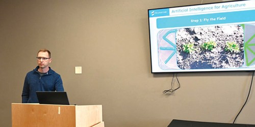
- Agronomist Patrick Williams highlights the benefits drones can offer in the agricultural industry during the Farm City Ag & Home Expo on March 7, 2025, at the Eastern Oregon Trade and Event Center in Hermiston. (Michael Kane/For the Hermiston Herald)
HERMISTON — When it comes to the agricultural industry, farmers are always looking for ways to increase productivity, efficiency and profitability. Few advancements have gone further to do just that than the use of drones.
Drones have changed the way farmers monitor their crops thanks to their high-resolution imagery, ground heat mapping and more.
Patrick Williams, chief agronomist for Skysense AI Inc., spoke Friday morning, March 7, about drones and their many applications during the Farm City Ag & Home Expo at the Eastern Oregon Trade and Event Center in Hermiston.
Drones can perform tasks much quicker and more precise than humans such as:
- Land imaging.
- Surveying topography and boundaries.
- Soil monitoring.
- Livestock movement and counting.
- Irrigation monitoring.
- Spraying needs.
- Collecting soil and water samples.
- Troubleshooting.
“We can do these ourselves, but not nearly as fast or as accurately as a drone can,” Williams said. “A drone can fly across a field much faster than I can drive a tractor over it.”
With the use of artificial intelligence, drones can hover over a crop and determine if what is coming up from the ground is what the farmer planted or if it’s a weed. They also can determine if the number of plants are what the grower anticipated or if a problem exists that’s limiting the plant growth.
The drone streams data it gathers to a tablet or computer, providing useful information and photos about land, crops and livestock.
“These images can identify what’s coming up and what’s not,” Williams said. “Maybe the seedlings aren’t there because they were eaten by a bird or simply didn’t sprout.”
More importantly, a drone can isolate which areas of a field are doing well and which are not — and can often help determine why a portion of a crop is suffering, providing a site-specific diagnosis.
“These high-resolution images will do a good job of telling you what’s going on,” he said.
In some cases, there may be an irrigation issue in one portion of the field that will prove detrimental to the crop. An aerial image can show if part of the field is getting too much or too little water. Data from drones can also tell the farmer which acres need more fertilizer or herbicide, and which acres need less.
“They can create an herbicide application map and tell you where to spray for weeds, so you aren’t spraying your plants,” Williams said. “Farmers have always been good stewards of the land, but in this process, we are becoming even better stewards of land. We’re always looking for ways to improve our stewardship.”
All of that saves the farmer time and money and helps produce better harvests.
Imagery produced by drones, Williams said, can also help a farmer before he or she even puts a single seed in the ground.
For example, an aerial image of the soil taken before planting has begun can show what areas of the field have healthy or unhealthy soil, allowing the farmer to take steps to improve soil health. Heat mapping, as it’s called, can help a grower decide where to plant.
Drones also can serve as security for a farmer’s land and deter predators – both animal and human — from doing damage.
Williams said drones can play an effective role in bird mitigation. Birds often descend on fields and eat the seedlings. A drone can be programmed to fly toward the birds and blare loud sounds to scare them off. In some cases, the sound could be a bird distress call or simply loud music.
“The speakers used can reach 120 decibels, which is pretty loud,” Williams said. “Farmers with bird problems can spend a fortune trying to deal with bird problems. Drones can save them a lot of money.”
Williams said the use of drones to scare off birds was an idea suggested by farmers.
“We were honestly surprised at how successful it was,” he said.
Drones also can fly over property and show if anyone is poking around. When an unauthorized person is spotted — typically at night, a recorded voice can be activated letting the intruder know someone is watching.
“It really is a pretty good security system,” Williams said.
The Federal Aviation Administration first granted exemptions for drone use in agriculture in 2015. Drone operators must take steps to ensure drones do not interfere with planes or other forms of aviation. Williams said safety precautions are programmed into drones to prevent them from flying beyond the prescribed flight pattern. If communication is lost between the drone and the on-ground pilot, a computer directs the drone to either turn back or land.
The Farm City Ag & Home Expo ran March 7 and 8 in Hermiston.


