WILDFIRE UPDATE: FEMA authorizes funds to fight Eastern Oregon fires
Published 7:15 am Tuesday, July 23, 2024
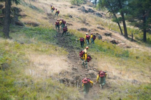
- A crew builds a fire line July 21, 2024, to contain a wildfire near Ukiah.
UKIAH — The Federal Emergency Management Agency authorized the use of federal funds to help with firefighting costs for the Boneyard Fire burning in Grant County and the Battle Mountain Complex Fire in Grant, Morrow and Umatilla counties.
The Monkey Creek, Snake, and North Fork Owens fires comprise the complex. The Oregon Department of Forestry Incident Management Team 3 in a press release reported firefighters were able to hold and construct line completely around the 3,887-acre North Fork Owens fire. Crews will continue to establish hose lays for mop up and patrol the perimeter.
On the 7,499-acre Snake Fire, crews held the fire to the west of Highway 395 while focusing on protecting structures and heading off the southeast corner of the fire, toward the town of Dale.
The fires started in the late afternoon and evening of July 17.
Winds out of the north and northwest pushed the 18,586-acre Monkey Creek Fire south towards Ritter. Firefighters caught a win by keeping the fire north of the John Day Middle Fork River.
According to ODF, difficult terrain is a major factor for where firefighters can place direct line as they attempt to safely maneuver steep, craggy hillsides and loose rocks. Firefighters are especially cautious of rolling debris and loose rocks. Officials have Rapid Extraction Module Support Teams along the fire as an extra precaution for firefighter safety.
Oregon requested federal Fire Management Assistance grant to take on the fires, according to a press release from FEMA Region 10.
FEMA Region 10 Administrator Willie G. Nunn on Saturday night, July 20, approved the grant request for the Boneyard Fire and on July 21 approved the request for the Battle Mountain Complex. he determined the Boneyard and Battle Mountain Complex fires “threatened to cause such destruction as would constitute major disasters,” according to the press release.
These are the fifth and sixth Fire Management Assistance grants in 2024 to help fight Oregon wildfires.
At the time of the state’s request, the wildfires threatened homes in and around the communities of Mountain, Kimberly, Dale, Ritter and Ukiah.
The Boneyard Fire also threatened Highway 402, cell towers, communications sites, private cooperative utilities, watersheds, irrigation infrastructure, cultural resources and recreational sites. The Battle Mountain Complex fire threatened Highway 395, cell towers, communications towers, private cooperative utilities, irrigation infrastructure, watersheds and cultural resources.
Money for the grants comes from the President’s Disaster Relief Fund and are available through FEMA to assist in fighting fires that threaten to cause a major disaster.
Eligible items can include expenses for field camps; equipment use, repair and replacement; mobilization and demobilization activities; and tools, materials and supplies. This authorization makes FEMA funding available to pay 75% of the state’s eligible firefighting costs under an approved grant for managing, mitigating and controlling designated fires. These grants do not provide assistance to individual home or business owners and do not cover other infrastructure damage caused by the fire.
In addition to these firefighting funds, another $1,970,222 will be available to Oregon through the Hazard Mitigation Grant Program Post Fire for the mitigation of future wildfires and related hazards, such as flood after fire or erosion. Some eligible wildfire project types include defensible space measures, ignition-resistant construction and hazardous fuels reduction. The Disaster Recovery Reform Act of 2018 authorizes FEMA to provide HMGP Post-Fire funds to eligible states and territories that receive Fire Management Assistance declarations and federally recognized tribes that have land burned within a designated area.
Evacuations: The Umatilla County Sheriff’s Office reported evacuation levels were removed for the Pilot Rock Fire and the Cold Spings Loop area on Weston Mountain.
For the Pilot Rock Fire, evacuation levels no longer are in effect for the area of south of Coombes Canyon Road and north of milepost 32 on Highway 395 South (Gurdane Road) between the county line on the west and just west of East Birch Creek.
For the Cold Spings Loop area, there are no evacuation levels south of Highway 204, east of Giger Lane to McDougal Road to include all residences on McDougal, south to Rock Creek including Pine Creek Road system east of Read and Hawley Mountain.
For updated evacuation information, visit the Umatilla County Sheriff’s Office Facebook page or sign up for the Umatilla County Emergency Alert System.
Evacuation maps also are available at oregon-oem-geo.hub.arcgis.com.
Fire restrictions can be found at www.bmidc.org or by calling the Northeast Oregon Fire Prevention line at 541-975-3027.
For fire information, go to bluemountainfireinfo.blogspot.com, or visit the Facebook page of the Oregon Department of Forestry’s Northeast Oregon District.
To report a fire, call the Blue Mountain Interagency Dispatch at 541-963-7171 or dial 911.


-
eEdition

-

-