WILDFIRE UPDATE: Containment climbs on fires near Ukiah
Published 3:30 pm Friday, August 9, 2024
UKIAH — Containment increased on the Battle Mountain Complex of fires near Ukiah as crews grow confident in their control lines on the southwest side.
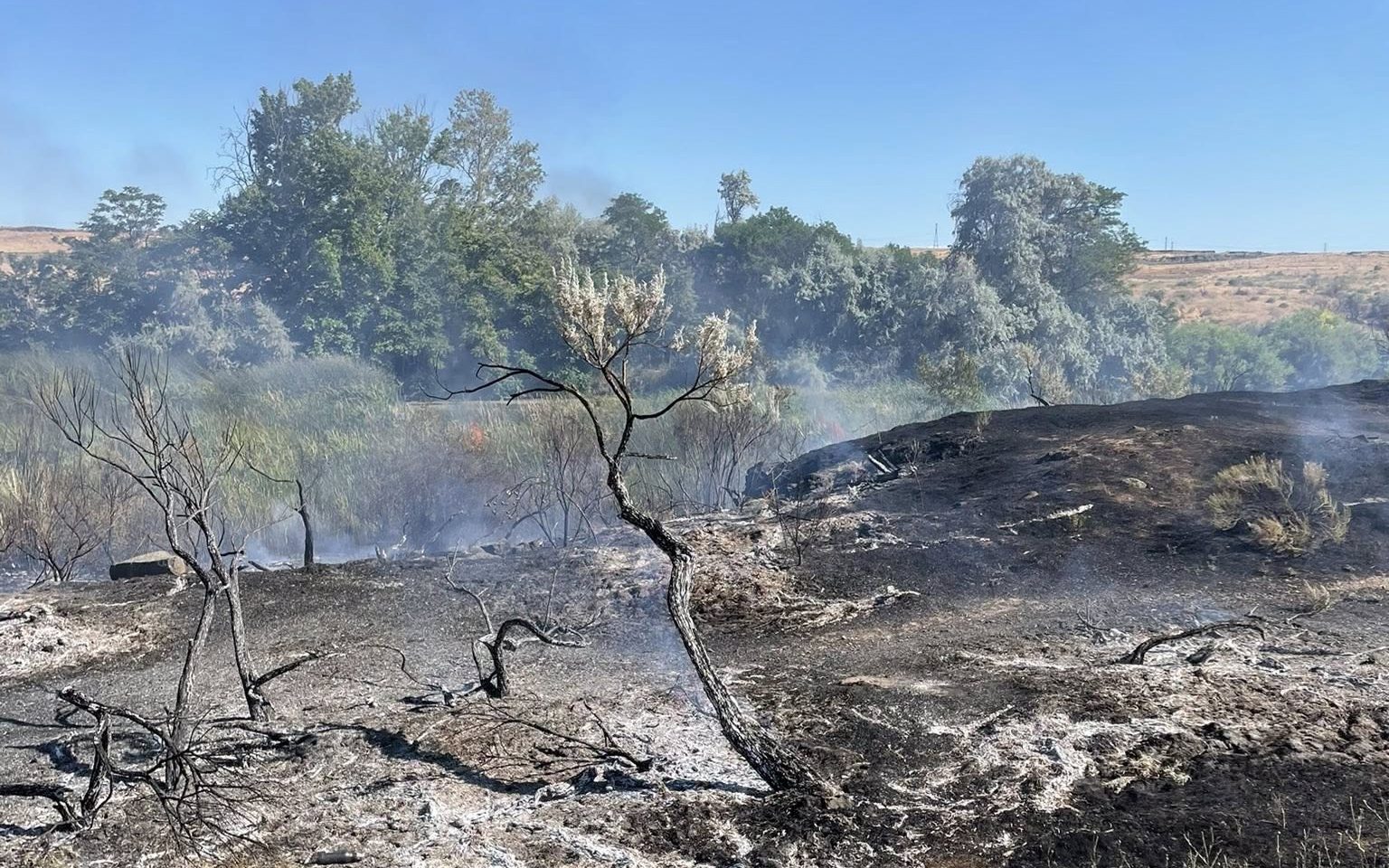
The Oregon Department of Forestry in its update on the fires Friday, Aug. 9, reported pockets of unburned fuel in Swale Creek and Ditch Creek continued to burn Aug. 8. Firefighters extinguished hot spots and ensured nothing threatened the containment lines.
Late in the afternoon of Aug. 8, two small spot fires crossed the containment lines just northwest of the Potamus drainage. Crews were swift to able to build line around the spots. And sawyers finished falling hazard trees on the southwest side of the fire, according to ODF.
The night shift patrolled most of the south side of the fire and continued looking for hot spots on the northside.
Firefighters on Aug. 9 are continuing mopping up and ensuring the remaining areas of unburned fuels around Notell, Swale and Ditch creeks do not threaten containment lines.
Masticators will reinforce the lines by removing brushy fuels north of the Potamus Creek drainage. Crews will continue checking for any remaining heat along the fireline southwest of Dale that is not contained.
As much of the southern half of the fire is moving into a patrol status, fire managers are turning the efforts toward repair of any impacts caused from the suppression effort. Resource advisors are working with firefighters to identify what repair is needed and what equipment or resources will be needed to complete the work.
Engines continue patrolling the North Fork Owens Fire daily.
Weather
Cloud cover will continue to build in the afternoon Aug. 9. A slight chance of rain is expected into the weekend, which may bring slightly increased winds. These isolated showers are not expected to bring much moisture but will increase the chance of dry lightning and new fire starts. Temperatures will gradually trend down into next week.
Smoke
Smoke from regional fires is expected to persist in the area. Residents can expect to continue to see smoke from interior pockets of unburned fuel as well as small burnout operations. Helicopter resources will patrol the fire and provide bucket-drop support where visibility allows. Additional smoke information: linktr.ee/battlemntcomplex2024.
For up-to-date evacuation information
Evacuation levels have decreased in many areas. Learn more about evacuation levels for each county:
Umatilla County — The Umatilla County Sheriff’s Office Facebook page or sign up for the Umatilla County Emergency Alert System.
Grant County — The Oregon Department of Emergency Management’s RAPTOR site or sign up for alerts here.
Morrow County — The Oregon Department of Emergency Management’s RAPTOR site.
Public land closures
The Bureau of Land Management has closed public lands along the John Day River from Kimberly to Dale, and from Kimberly to Service Creek. Find more information here.
The Umatilla National Forest has implemented a closure for public lands within the Heppner Ranger District and the North Fork John Day Ranger District. More information is available here and here.
Total estimated complex size: 182,766 acres
Monkey Creek Fire: 177,757 acres
North Fork Owens Fire: 4,484 acres
Total containment: 61%
Cause: under investigation
Estimated cost: $54 million
All resources
Hand crews: 59
Engines: 70
Water tenders: 40
Dozers: 25
Helicopters: 9
Total personnel: 1,733
Mop-up consists of firefighters working around the perimeter of a fire and into the burn to extinguish lingering hot spots to create a cooled buffer so materials don’t reheat and cross control lines, according to the Oregon Department of Forestry.