WILDFIRE UPDATE: Firefighters expand mop-op operations near Ukiah
Published 1:00 pm Thursday, August 1, 2024
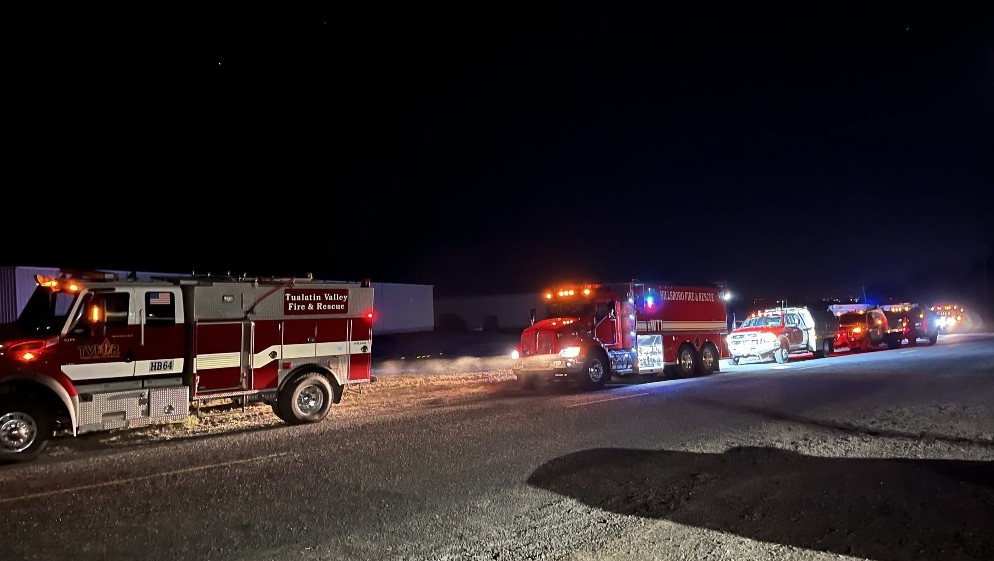
UKIAH — Mop-up and suppression operations continue to go well for firefighters across the Battle Mountain Complex near Ukiah.
The Oregon Department of Forestry in its update Thursday, Aug. 1, on the wildfire complex reported crews in Zone 1 secured fire perimeters in the south near Steet Mountain, in the west near Turner Mountain and in the north near Tupper Butte and show minimal fire activity.
While the majority of Zone I entered a heavy mop-up phase, firefighters working on the southwest perimeter, near Cupper Canyon, responded to several spot fires inside a pocket of unburned vegetation within the main body of the fire.
“Firefighters used strategic firing operations to secure the rest of this area overnight and mitigate any future risk of the fire flaring up in this area as officials expect temperatures to rise to 100-110 degree this weekend,” according to the report. “By completing this work overnight, firefighters were able to conduct the operations safely when low wind speeds, increased humidity, and milder temperatures prevented spot fires and increases in fire activity.”
Officials expect critical weather to return during the next few days with a heat advisory in effect Aug 1 from 11 a.m. to 8 p.m. and a fire weather watch arriving Aug. 2. The change in weather brings unstable conditions with the possibility of thunderstorms Aug. 3-6.
“The saving grace may be the addition of precipitation with the forecast storm event,” according to the report.
Resources across Zone I and II will continue mopping up on Aug. 1 while monitoring and patrolling areas of line that no long hold heat, especially around structures.
ODF also reported the focus in Zone II remains the Potamus Drainage as dozer and hand line start to come together on both sides of the creek within the canyon. Crews and heavy equipment worked with helicopter air support to stay ahead of any flareups and spot fires. Crews will continue to strengthen lines in the area with helicopter support as needed.
For up-to-date evacuation information
Evacuation levels have decreased in many areas. Learn more about evacuation levels for each county:
Umatilla County — The Umatilla County Sheriff’s Office Facebook page or sign up for the Umatilla County Emergency Alert System.
Grant County — The Oregon Department of Emergency Management’s RAPTOR site or sign up for alerts here.
Morrow County — The Oregon Department of Emergency Management’s RAPTOR site.
Public land closures
The Bureau of Land Management has closed public lands along the John Day River from Kimberly to Dale, and from Kimberly to Service Creek. Find more information here.
The Umatilla National Forest has implemented a closure for public lands within the Heppner Ranger District and the North Fork John Day Ranger District. More information is available here and here.
Total estimated complex size: 178,171 acres
Monkey Creek Fire: 173,687
North Fork Owens Fire: 4,484 acres
Total containment: 19%
Cause: under investigation
Estimated cost: $33,325,411
All resources
Hand crews: 66
Engines: 87
Water tenders: 39
Dozers: 28
Helicopters: 4
Total personnel: 2,009

-
eEdition

-

-