Forecast provides little relief going forward
Published 9:29 am Sunday, July 11, 2021
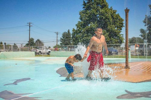
- Damian Villarreal, right, and Malachi Acosta play in the water at the Butte Spray Park in Hermiston on June 28, 2021 as temperatures reached 115 degrees.
HERMISTON — The calendar has long since flipped from February, but it would be easy to forgive Hermiston and surrounding communities for feeling like they are trapped in a perpetual Groundhog Day.
Record heat has defined early summer and little precipitation has been the theme of the year. Relief on either front isn’t in the forecast over at least the next week.
Trending
“We do expect temperatures to remain above normal — not the excessive heat we saw at the end of June — in the low to mid-90s instead of readings around 100,” Pendleton National Weather Service hydrologist Marilyn Lohmann said.
Normal highs for Pendleton and Hermiston are in the upper 80s this time of year, but triple-digit temperatures usually reserved for late July and August already have become common. The National Weather Service issued a Red Flag Warning for the eastern Gorge, the Columbia Basin and Central Oregon that is effective Wednesday, July 14, at noon, until July 15 at 11 p.m.
The warning states gusty winds and low humidity could lead to new fires and help existing fire spread.
The extreme heat in late June came with a strong area of high pressure that trapped the warm air, Lohmann said.
“Outside of the irrigated areas, the grasses and soils are very dry, and with little moisture there temperatures can heat up even more,” she said. “That feedback loop led to those extreme temperatures.”
Gov. Kate Brown declared Umatilla County in a drought disaster in an executive order last month.
Trending
The county was one of four — along with Grant, Union and Wasco counties — that Brown announced was facing “a severe, continuing drought emergency” that is projected to continue as conditions are unlikely to improve, the order said.
Normal rainfall for much of the area in July is just a quarter of an inch. Pendleton’s normal rainfall for June is in the .5-1 inch range, according to NWS data, but this year is was below half an inch. June saw just 0.23 tenths of an inch of rain in Hermiston, well below the 0.64 tenths in a normal year.
The picture doesn’t improve looking at precipitation so far this year at the Hermiston airport. Lohmann said just 1.79 inches has been recorded since January, 4.23 inches below normal. The water year, which starts in October, is at 4.63 inches, 4.71 below normal. Lohmann gives it less than a 50% chance that the deficit will be made up this year.
“The August, September and October forecast still shows above normal temperatures and below normal precipitation for the area,” she said.
The drought has taken its toll on crops with lower yield on wheat and barley. Lohmann said municipal water systems in the area have avoided issues so far, but that is not the case across the state.
“In north central Oregon and into south-central Washington they have had some dry wells already and are having to drill deeper,” she said.
The dry conditions also have led to the early arrival, by more than a month, of fire season and the potential for larger fires.
Marketplace


-
eEdition

-

-
